Commercial Roofing Services · Garden Grove, CA
Drone Roof Inspection in Garden Grove, CA
Drone Roof Inspection
Drone roof inspection in Garden Grove, CA documents broad roof conditions and directs close checks of seams, drainage, equipment, and edges.
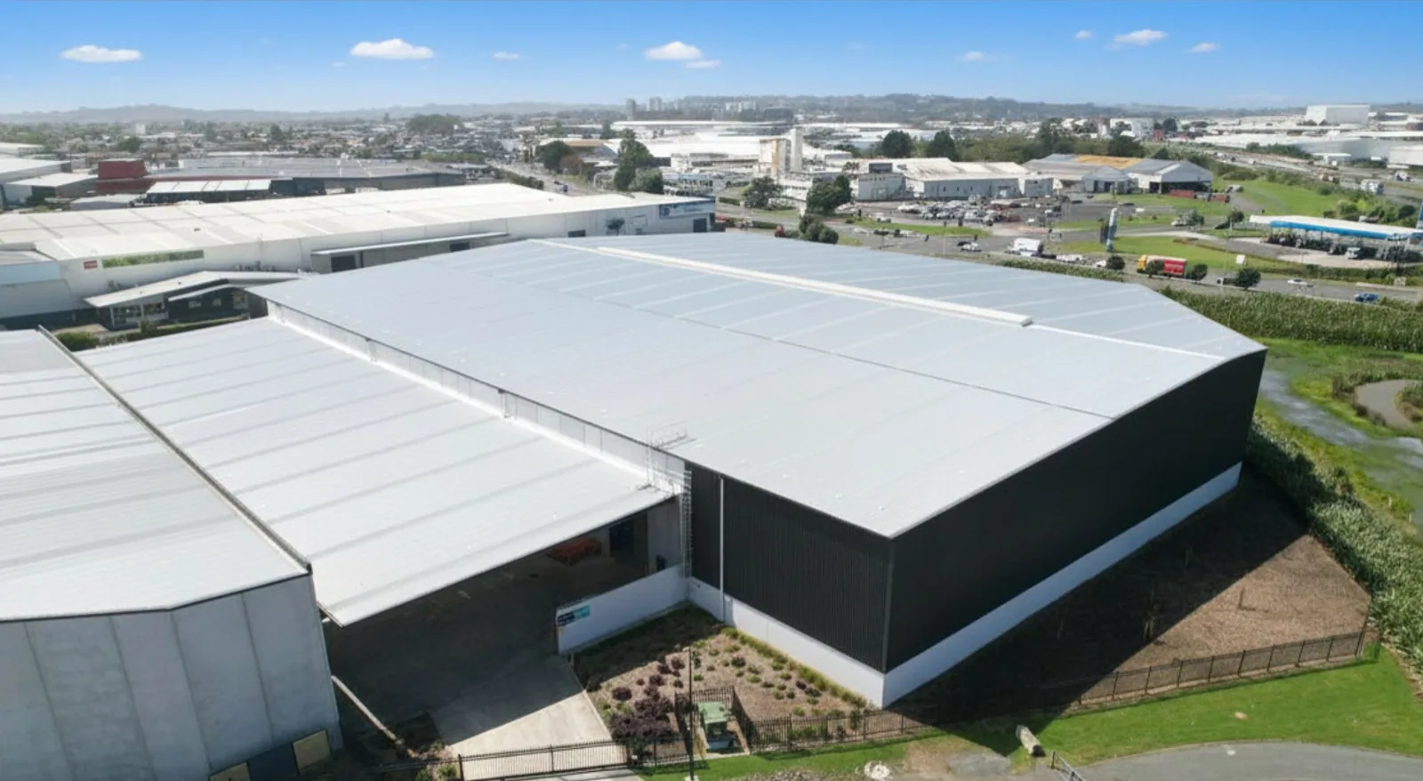
Aerial images are most useful when they answer a roof question that is hard to see from the access point. During a drone roof inspection in Garden Grove, CA, we use planned views to document broad field conditions, edge continuity, rooftop equipment, and areas that need a closer walk. The images do not reveal the condition beneath a membrane or replace hands-on checks at seams and flashings. We define the inspection goal first, confirm that the flight can be conducted safely and lawfully, then connect each image to a roof zone and follow-up action. The owner receives a record that supports a measured next step.
Plan the Images Around a Roof Question
A useful flight begins with a map of the roof and a question: where are ponding patterns visible, which equipment clusters need documentation, or how does an edge continue around a large footprint? We set image angles and overlap to capture the intended area, while avoiding people, active work, and restricted airspace. Flight conditions, obstructions, and camera limits affect what can be recorded. The image set is labeled by zone and date, then compared with plans or earlier records when available. Overlapping views give future inspections a consistent reference for the same roof area. A roof inspection still needs hands-on confirmation where a seam, penetration, or material bond determines the repair.
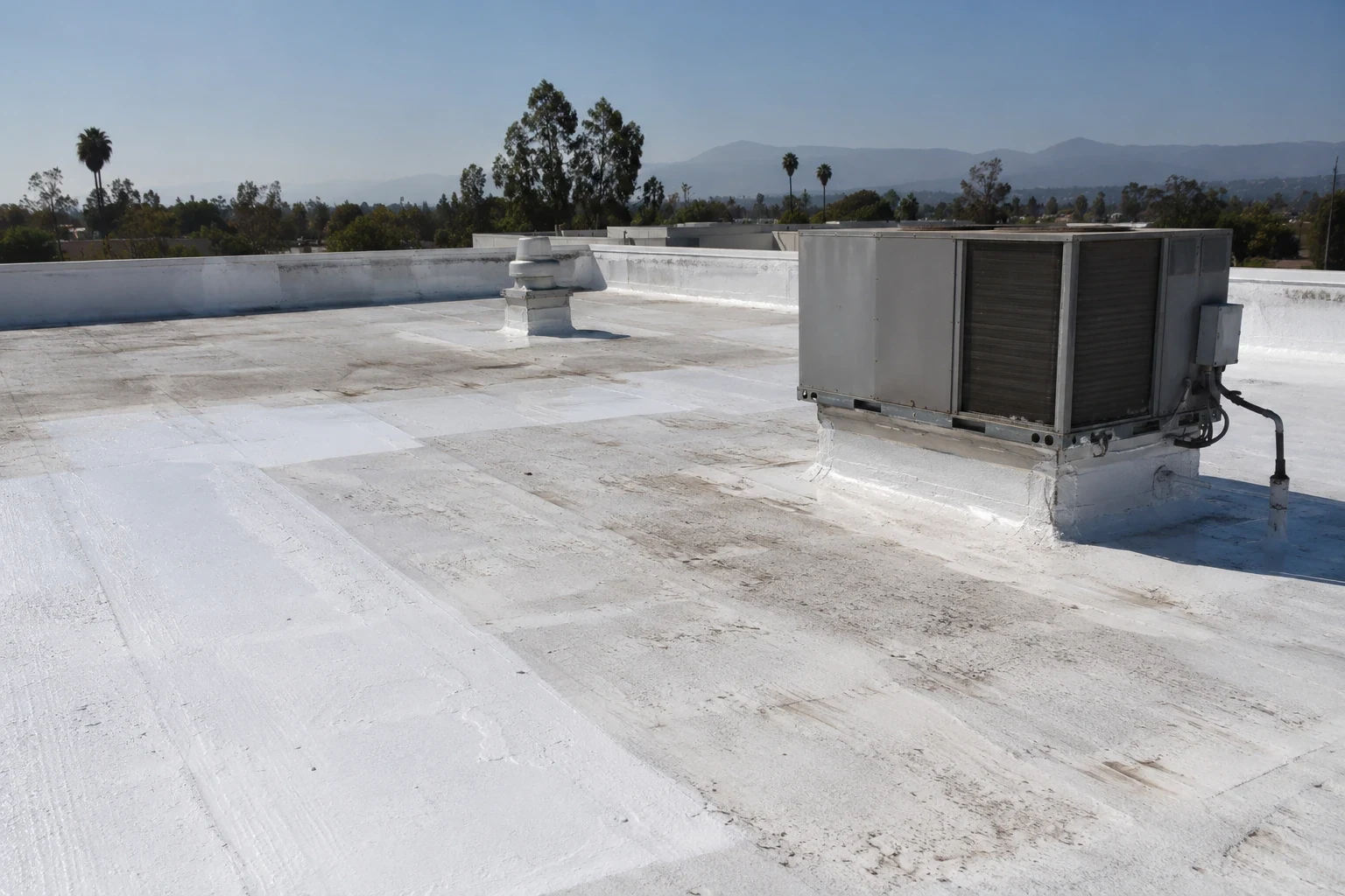
Garden Grove has varied commercial, office, industrial, and mixed-use areas. On a building near Garden Grove Boulevard, views may help show roof features above multiple tenant bays; in the Knott Street and Western Avenue industrial district, the flight plan may need to account for rooftop process equipment and safe separation. We use the image to locate the roof zone and plan a hands-on inspection of the equipment interface and its flashing.
We also note the direction of each view and the roof feature used as a reference point. That makes a later walk easier to coordinate when a facility team reports a new leak or a contractor needs to locate a curb shown in the image set.
Separate Visible Patterns From Confirmed Defects
From above, discoloration, debris lines, standing water, patch shapes, and equipment shadows can look similar. We mark observations as visible patterns, then check whether the surface or drainage detail confirms a defect. An aerial image may show that water collects in a zone, but it does not establish how long ponding persists or whether insulation is wet. Likewise, a dark patch may be a repair, a coating variation, or residue. The report avoids assigning a cause until the close view or test opening supports it. That distinction keeps a photo-based observation from becoming an unsupported repair claim.
When images point to a low area or suspect seam, a moisture survey or test cut may identify where the next check has value. A confirmed open seam can route to a seam repair; blocked drainage may need a separate drain correction. The drone helps map where to look, while the roof surface and concealed assembly establish the repair boundary. We include both the image reference and the field check in the final record.
Use Image Capture Alongside the Roof Record
Different roof materials appear differently in overhead photographs, but image color alone does not reliably identify the system. We note visible seams, panel lines, equipment, penetrations, and edge transitions, then compare those observations with plans, labels, and accessible details. The report names the material only after a label, plan, or accessible detail confirms it. A close inspection checks seam attachment, fasteners, flashing laps, and coating bond. When the roof is divided into phases, consistent camera angle and zone naming make later comparisons more useful than an unstructured set of images.
The adopted 2025 California Building Code and local Title 18 modifications may guide a future permit review, but aerial documentation does not determine compliance. We coordinate project questions with the owner and building official. For a roof where visible wear prompts system planning, we can compare a TPO system with a metal roof option after checking substrate, drainage, and structure. The images support that conversation by showing access and roof features; the design depends on conditions found during inspection.
Coordinate the Flight With Site Conditions
Before launch, we identify roof access, takeoff and landing areas, overhead obstructions, people below, and any site restrictions. A flight may need to move to another time if wind, visibility, or nearby activity makes it unsafe. We protect the building's privacy by keeping the inspection focused on the roof and avoiding unnecessary views into occupied areas. The property contact should know where the crew will work and which areas below need temporary clearance. If the flight cannot safely capture a detail, a ladder or roof walk may be the better method.
Trask Avenue's planned auto-sales and repair cluster can make vehicle circulation relevant to a flight and roof-access plan at nearby properties. Before a flight near Trask Avenue, we confirm the current traffic pattern, takeoff area, and any operating limits with the property contact. Our occupied-building sequence coordinates access when follow-up roof work is needed. For multiple buildings, we identify each structure separately so photographs remain attached to the correct roof record.
Deliver Images With a Finding Key
The final image set includes date, roof-zone labels, a finding key, and notes that separate aerial observations from hands-on inspection. Images that do not answer the inspection question are excluded from the repair record. The owner can use the labeled views to locate drains, rooftop equipment, and broad surface patterns during a future service visit. Where the images show an area that could not be reached, we describe the access limit and recommend a safe follow-up method. The image key connects each photograph to a roof zone and the field check that followed.
After repairs, repeat views can help compare broad surface conditions, though they do not prove a seam remains bonded or insulation is dry. A condition report can pair those images with field observations. If an aerial view prompts concern, the next step is a targeted roof inspection that tests the condition in question, not a conclusion drawn from the image alone.
Commercial Roofing Questions
What can a drone show that a roof walk might miss?
An overhead view can document broad drainage patterns, edge continuity, rooftop equipment layout, and areas that are difficult to see from a hatch or ladder. It cannot confirm membrane adhesion, moisture below the surface, or the condition of a concealed detail. We use the image to plan closer inspection where needed.
Can drone photographs diagnose a leak?
They can help locate visible features around the reported area, but a photograph alone rarely establishes the water-entry path. We compare the interior report with roof details and use a close inspection or test opening when required. Any repair recommendation identifies the field condition that supports it.
Will the drone inspection interrupt our building?
We coordinate launch and landing areas with the site contact and keep people clear of the immediate work zone. Weather, overhead obstructions, and local flight restrictions can change the plan. If a safe flight is not available, we use another inspection method or reschedule the aerial portion.
How are the images delivered?
We label usable views by roof zone and provide a short key that identifies visible observations and any follow-up checks. The record separates aerial observations from findings confirmed during the roof walk. That lets a facility team locate an item later without treating an image pattern as a confirmed defect.
Measure the roof before choosing the repair path
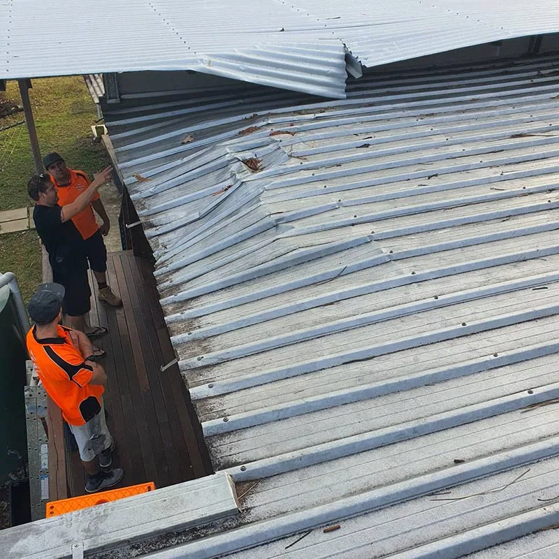
Arrange a roof walk with available plans, leak records, and access constraints. We will trace the assembly, mark the work boundary, and prepare a scope for your Garden Grove building.
Or call 555-555-5555 · [email protected]